NASA's PACE Satellite, Designed for Oceans, Reveals Unexpected Wildfire Monitoring Capabilities
NASA's PACE satellite, primarily built for ocean and atmosphere study, is proving invaluable for monitoring wildfires, smoke plumes, and vegetation health from space. Its hyperspectral data offers…
A NASA satellite designed to meticulously study Earth's oceans and atmosphere has unveiled a surprising and critical secondary capability: monitoring wildfires from space. The Plankton, Aerosol, Cloud, and ocean Ecosystem (PACE) mission, launched in February 2024, is providing unprecedented views of smoke plumes, vegetation health, and burn scars across the globe, offering a new dimension to our understanding of these increasingly prevalent natural disasters. This unexpected utility highlights the remarkable versatility of advanced space technologies and their potential to address challenges far beyond their initial design specifications.
What happened
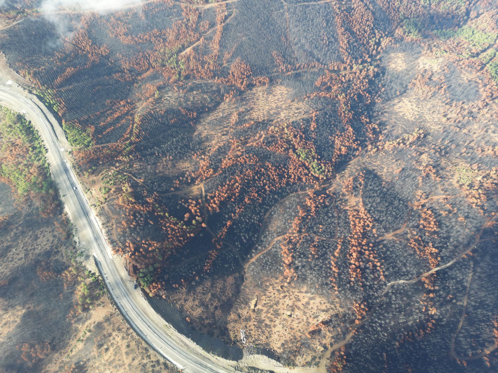
NASA's PACE satellite, equipped with its sophisticated Ocean Color Instrument (OCI), recently captured detailed images of wildfire smoke swirling over the Great Lakes region in Canada. While the OCI's primary role is hyperspectral imaging of the planet in hundreds of wavelengths across visible, near-infrared, and ultraviolet light to study marine ecosystems and atmospheric components, it has demonstrated an exceptional ability to observe terrestrial phenomena. This includes not only the distinct wisps of gray smoke from massive wildfires but also subtle changes in vegetation health and the charred aftermath of burn scars.
Beyond smoke detection, PACE's hyperspectral data allows scientists to assess the stress, dryness, and pigment balance of plants on Earth's surface. This detailed information is crucial for identifying areas at higher risk of wildfires. The satellite's other two instruments, the Hyper-Angle Rainbow Polarimeter 2 (HARP2) and the Spectro-polarimeter for Planetary Exploration (SPEXone), further enrich this data by providing insights into the quantity, chemical properties, color, size, and shape of atmospheric aerosols, enabling scientists to differentiate smoke from other particulates like dust or pollutants.
Why it matters
The unexpected wildfire monitoring capabilities of the PACE satellite hold significant implications for both scientific research and practical disaster management. By providing daily global coverage, especially at high latitudes, PACE enables rapid assessment of fire aftermath, including the location and span of burn scars. This is vital for identifying areas prone to increased flood and landslide risks following a fire, allowing land managers to allocate resources more effectively for mitigation and recovery efforts.
Furthermore, the detailed hyperspectral and polarimetric data from PACE will help scientists create more accurate wildfire models. Understanding how smoke particles drift high into the atmosphere and impact distant Earth systems is crucial for predicting their broader environmental effects, from air quality to climate patterns. This enhanced observational capacity allows for better strategic decision-making in deploying firefighting assets and issuing evacuation orders, ultimately contributing to improved safety and resilience in fire-prone regions.
- Provides versatile data beyond its primary mission, enhancing Earth observation capabilities.
- Offers detailed hyperspectral insights into vegetation health, smoke plumes, and burn scars.
- Aids in identifying high-risk areas for wildfires and monitoring post-fire environmental changes.
- Wildfire monitoring is not its explicit primary purpose, requiring adaptation of data interpretation.
- The rich hyperspectral data presents a challenge in translating complex clues into meaningful model inputs.
- Requires integration with existing wildfire monitoring systems to maximize its operational impact.
How to think about it
The PACE satellite's unexpected utility in wildfire monitoring serves as a powerful reminder of the serendipitous discoveries and multi-purpose potential inherent in advanced scientific missions. When evaluating new space technologies, it's important to consider not just their stated primary objectives, but also their broader observational capabilities. Instruments designed for one specific domain, like ocean color, can often yield invaluable data for entirely different fields, such as terrestrial wildfire management. This calls for an interdisciplinary approach to data analysis, where scientists from various fields collaborate to unlock the full spectrum of insights available from a single satellite platform. Embracing this holistic view can lead to more comprehensive understanding of Earth's interconnected systems and more effective solutions to global challenges.
FAQ
What is the primary mission of NASA's PACE satellite?+
The PACE satellite's primary mission is to study Earth's oceans and atmosphere, focusing on plankton, aerosols, clouds, and ocean ecosystems. It aims to understand how these components interact and influence Earth's climate and biodiversity.
How does PACE help with wildfire monitoring if it's designed for oceans?+
PACE helps with wildfire monitoring through its advanced Ocean Color Instrument (OCI), which performs hyperspectral imaging across hundreds of wavelengths. This capability allows it to detect smoke plumes, assess the health and dryness of vegetation (which indicates fire risk), and map burn scars left behind by wildfires, even though its primary focus is aquatic environments.
What makes PACE's data unique for studying wildfires compared to other satellites?+
PACE's uniqueness lies in its hyperspectral imaging, which provides data in hundreds of wavelengths, offering far more detailed information than many other instruments. Additionally, its HARP2 and SPEXone instruments provide specific data on the composition, size, and shape of atmospheric aerosols, enabling scientists to differentiate smoke from other particles and understand its properties more precisely. This breadth of data enhances wildfire modeling and risk assessment.
- 01 Ocean-monitoring satellite spots wildfire smoke from space | Space photo of the day for July 1, 2026
- 02Ocean-monitoring satellite spots wildfire smoke from space | Space photo of the day for July 1, 2026
- 03NASA’s PACE Mission Studies Smoke, Fires - NASA Science
- 04Wildfires from Space: How the View from Above Helps Firefighters on the Ground
- 05NASA-FIRMS
- missions·5 min readNASA Launches Daring Rescue Mission to Save Swift Space Telescope from Atmospheric Reentry
NASA is launching a critical mission to save the Swift Observatory from burning up in Earth's atmosphere. A private spacecraft will grapple and tow the telescope to a higher orbit, extending its…
- missions·7 min readNASA's Artemis Program: Building a Permanent Presence on the Moon
More than fifty years after Apollo 11, NASA is sending humans back to the Moon — but this time with the explicit goal of staying. Artemis aims to land the first woman on the lunar surface and create infrastructure for permanent human presence and eventual Mars missions.
- astronomy·5 min readChandra X-ray Observatory Unveils 'Red, White, and Blue' Cosmic Images for US 250th Anniversary
NASA's Chandra X-ray Observatory celebrates the US 250th with stunning 'red, white, and blue' cosmic images and sonifications, revealing the universe's wonders.